The City of Seattle
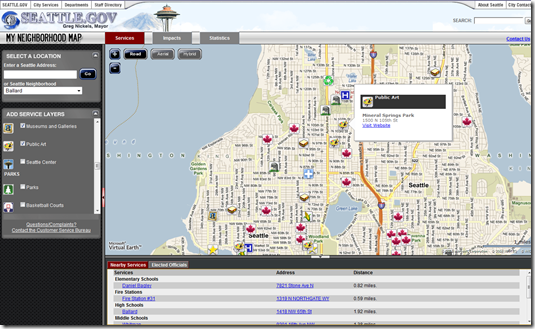
 Thank you Mayor Greg Nickels! The City of Seattle has embraced Microsoft Virtual Earth for their “My Neighborhood” mapping application and WOW – I’ve never seen so much useful data in such a simple format with a map-based interface. You want to talk about a central web site to get some truly local information (if you’re a Seattlite).
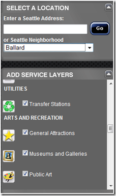
 Check out the list of layers of information being published for public use.
- Community
- Cemeteries
- Farmers Market
- Food Banks
- Community Health Centers
- Public Health Centers
- Heritage Trees
- Hospitals
- Landmarks
- Libraries
- Neighborhood Service Centers
- P-Patches
- Pet License Sales
- Public Restrooms
- Public Safety
- Fire Hydrants
- Fire Stations
- Police Precincts
- Transportation
- Motorcycle Parking
- Park N Ride
- Traffic Cameras
- Utilities
- Transfer Stations
- Arts and Recreation
- General Attractions
- Museums and Galleries
- Public Art
- Seattle Center
- Parks
- Parks
- Basketball Courts
- Boat Launches Ceremonies
- Children’s Play Areas
- Community Centers
- Environmental Learning Centers
- Fire Pits
- Fishing
- Golf Courses
- Off Leash Areas
- Picnic Sites
- Playfields
- Gardens
- Beaches
- Pools
- Tennis Courts
- Viewpoints
- Wading Pools
- Waterfront
- Education
- Elementary Schools
- Middle Schools
- High Schools
- Alternative Schools
- Higher Education
Whew! That’s quite the list. Just check the box you’re interested in and it will appear on the map. Move your mouse over a particular pushpin to get more information about the respective location. Oh, and don’t miss the list below the map which will re-center the map on a respective location if you click on it or launch you off to a web site if one exists. You can also move the map around to focus on a particular location or enter a specific address to get down to a particular address or select a neighborhood. I can’t stop checking boxes! I’m thirsty for information. Thanks Seattle!
CP
Comments
- Anonymous
January 13, 2009
This application is connecting to Seattle's Oracle Spatial 10g database using the MapDotNet Feature Web Service to query different service types like Health Centers, Hospitals, Landmarks, Farmers Markets, Schools and more. Using the MapDotNet SDK, the City is easily converting the data returned from Oracle to VEShapes and populating the map for visualization. http://www.mapdotnet.com/blog/Lists/Posts/Post3.0.aspx?ID=54
