X, Y, Zoom TileLayer
Note
Bing Maps Web Control SDK retirement
Bing Maps Web Control SDK is deprecated and will be retired. Free (Basic) account customers can continue to use Bing Maps Web Control SDK until June 30th, 2025. Enterprise account customers can continue to use Bing Maps Web Control SDK until June 30th, 2028. To avoid service disruptions, all implementations using Bing Maps Web Control SDK will need to be updated to use Azure Maps Web SDK by the retirement date that applies to your Bing Maps for Enterprise account type. For detailed migration guidance, see Migrate from Bing Maps Web Control SDK and Migrate Bing Maps Enterprise applications to Azure Maps with GitHub Copilot.
Azure Maps is Microsoft's next-generation maps and geospatial services for developers. Azure Maps has many of the same features as Bing Maps for Enterprise, and more. To get started with Azure Maps, create a free Azure subscription and an Azure Maps account. For more information about azure Maps, see Azure Maps Documentation. For migration guidance, see Bing Maps Migration Overview.
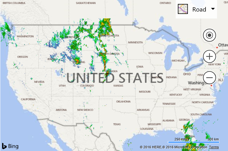
This example shows how to display a tile layer that uses an X, Y and Zoom tile URL schema. The source of this tile layer is a weather radar overlay from the Iowa Environmental Mesonet of Iowa State University.
<!DOCTYPE html>
<html>
<head>
    <title></title>
    <meta charset="utf-8" />
    <script type='text/javascript'
            src='https://www.bing.com/api/maps/mapcontrol?callback=GetMap'
            async defer></script>

    <script type='text/javascript'>
    var map;

    function GetMap() {
        map = new Microsoft.Maps.Map('#myMap', {
            credentials: 'You Bing Maps Key',
            center: new Microsoft.Maps.Location(40.75, -99.47),
            zoom: 4
        });

        //Weather radar tiles from Iowa Environmental Mesonet of Iowa State University
        var weatherTileLayer = new Microsoft.Maps.TileLayer({
            mercator: new Microsoft.Maps.TileSource({
                uriConstructor: 'https://mesonet.agron.iastate.edu/cache/tile.py/1.0.0/nexrad-n0q-900913/{zoom}/{x}/{y}.png'
            })
        });
        map.layers.insert(weatherTileLayer);
    }
    </script>
</head>
<body>
    <div id="myMap" style="position:relative;width:600px;height:400px;"></div>
</body>
</html>
Running this code in a browser will display a weather radar tile layer over top of the USA.