Windows 7 Release Candidate Available…Where’s Virtual Earth?
 With the release of Windows 7 RC to the world which you can now freely download from the Microsoft Windows web site, I figured I would at least let you know where Microsoft Virtual Earth fits into the equation. First off, there’s a location API built into the operating system. This means that from within Windows your applications can access a single API that will tell you where the user is. Well, any time you have location information it’s pretty much a given that you’ll want to see it on a map. So, as you start diving into the Windows 7 API I’m going to expect some killer Virtual Earth apps, so send them my way.
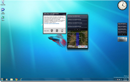
In the meantime, I thought I’d point out at least one Virtual Earth application that you can expect to have some fun with. Actually, it’s a gadget for reading GeoRSS feeds from your desktop. The folks at The Carbon Project have released a gadget on behalf of the National Spatial Data Infrastructure (NSDI) Cooperative Agreement Program (CAP) as an open source desktop dashboard for Geodata.gov, the federal government service for maps and data providing an “at-a-glance” visualization of geospatial assets and monitoring of Geospatial One-Stop (GOS) Portal search functions. The Dashboard is based on Microsoft Gadgets and enhances common RSS functions with the ability to configure searches, view geodata footprints on a mini-map, and access desktop GIS applications from ESRI and other vendors directly with the data people find.
For more information about the project, check out the Carbon Cloud blog. Go download Windows 7…you seriously won’t regret it.
CP
