Azure Open Datasets
An Azure service that provides curated open data for machine learning workflows.
27 questions
This browser is no longer supported.
Upgrade to Microsoft Edge to take advantage of the latest features, security updates, and technical support.
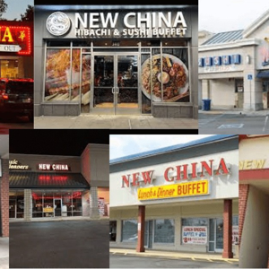
I am not interested in making an app for public use. I am interested in the data itself for internal use on a project dedicated to understanding the different types of Convenience stores based on store attributes. I have Address and Lat/Long lookups for…
' cx='32' cy='32' r='32' /%3E%3Ctext x='50%25' y='55%25' dominant-baseline='middle' text-anchor='middle' fill='%23FFF' %3ECS%3C/text%3E%3C/svg%3E)
I have just installed Streets & Trips 2013 I cannot select, edit, or delete the trails created while driving using the GPS. I had the 2006 version. I could edit the trail, it is by default colored blue.
' cx='32' cy='32' r='32' /%3E%3Ctext x='50%25' y='55%25' dominant-baseline='middle' text-anchor='middle' fill='%23FFF' %3EDS%3C/text%3E%3C/svg%3E)

We set the external image link ('https://flagpedia.net/data/flags/normal/fr.png') as the image source, and the cross-origin is set to anonymous. When the image onload event is triggered, at this point, we create a pushpin and add the pushpin to map…
' cx='32' cy='32' r='32' /%3E%3Ctext x='50%25' y='55%25' dominant-baseline='middle' text-anchor='middle' fill='%23FFF' %3EJE%3C/text%3E%3C/svg%3E)

Hi, I have been using Bing Maps in Power BI dashboard for a few months now, and it has always been working fine, but lately, I am getting this error message multiple times a day whenever I refresh the dashboard. Could anyone please help me? This is the…
' cx='32' cy='32' r='32' /%3E%3Ctext x='50%25' y='55%25' dominant-baseline='middle' text-anchor='middle' fill='%23FFF' %3ECC%3C/text%3E%3C/svg%3E)
Hello, I faced an issue with Directions module on module load. There is a console error: Uncaught ReferenceError: sj_evt is not defined. This issue occurs even when bing API key is used, and can be reproduced on code sample from this topic:…
I am working the Distance Matrix API to identify travel times between origin and destination coordinates. My question is about how this travel time is calculated. From what I can ascertain from the supporting information, if a start or end time is…
Hello Microsoft, I hope this message finds you well. My name is Elena, and I am a software developer currently working on implementing a feature for capturing dynamic photos using Bing Maps. I have a question regarding the "showHeadingCompass"…
' cx='32' cy='32' r='32' /%3E%3Ctext x='50%25' y='55%25' dominant-baseline='middle' text-anchor='middle' fill='%23FFF' %3ESE%3C/text%3E%3C/svg%3E)
I want to display all the nearby landmarks such as shopping centers, restaurants, hotels, petrol pumps, etc. on the map created using Bing Maps V8 Web Control like how https://www.bing.com/maps/ shows. But I cannot find a configuration or setting to…
' cx='32' cy='32' r='32' /%3E%3Ctext x='50%25' y='55%25' dominant-baseline='middle' text-anchor='middle' fill='%23FFF' %3EPM%3C/text%3E%3C/svg%3E)
I put in my map service token key and my search bar to search for any location is not working on the bottom of screen is saying Warning: Map Service Token not specified for my uwp google earth like app

This occurred two months ago, lasted for several weeks, then mysteriously fixed itself for myself as well as other users around the world. It appears to be back this morning. Please see prior question…
' cx='32' cy='32' r='32' /%3E%3Ctext x='50%25' y='55%25' dominant-baseline='middle' text-anchor='middle' fill='%23FFF' %3EP%3C/text%3E%3C/svg%3E)

Hi, Recently, about 6 weeks ago, some of our users are saying that after a few hours of running our app, they are getting the "Warning map service token not specified." message at the bottom of map. Our app has been in use for over 8 years and…
' cx='32' cy='32' r='32' /%3E%3Ctext x='50%25' y='55%25' dominant-baseline='middle' text-anchor='middle' fill='%23FFF' %3EKK%3C/text%3E%3C/svg%3E)
' cx='32' cy='32' r='32' /%3E%3Ctext x='50%25' y='55%25' dominant-baseline='middle' text-anchor='middle' fill='%23FFF' %3EID%3C/text%3E%3C/svg%3E)
var manager; function loadMapScenario() { Microsoft.Maps.loadModule('Microsoft.Maps.AutoSuggest', { callback: onLoad, errorCallback: onError }); function onLoad() { …

how can i get like this autosuggestion address with lat long Bing map API
We're integrating Bing basemap data into an Openlayers map. There are a couple Bing Maps layers that we need to display, but acquiring the corresponding metadata for those tiles doesn't seem to be well documented. The two layer types we're interested in…
I've been brought here from the following thread:…
We have a requirement to set the Bing Maps user region dynamically after loading without using url parameters. We can see in the below documentation link to customize the map option on load, but passing the setting the value of ur is not…
' cx='32' cy='32' r='32' /%3E%3Ctext x='50%25' y='55%25' dominant-baseline='middle' text-anchor='middle' fill='%23FFF' %3ES%3C/text%3E%3C/svg%3E)
Is there any API available which I'm not aware of which provides information that given lat-long is water or land? Here is the video showcase what I want exactly: https://www.loom.com/share/7017c596d5de4daabe0750c932ad33b7 I want to check if on click…
' cx='32' cy='32' r='32' /%3E%3Ctext x='50%25' y='55%25' dominant-baseline='middle' text-anchor='middle' fill='%23FFF' %3ESS%3C/text%3E%3C/svg%3E)
' cx='32' cy='32' r='32' /%3E%3Ctext x='50%25' y='55%25' dominant-baseline='middle' text-anchor='middle' fill='%23FFF' %3ED%3C/text%3E%3C/svg%3E)
We are using Map control (Windows.UI.Xaml.Controls.Maps) in UWP App. We are generating Route for some list of zipcodes. To get BasicGeoposition using Method (Windows.Services.Maps. MapLocationFinder.FindLocationsAsync). We found this method returns Null…
' cx='32' cy='32' r='32' /%3E%3Ctext x='50%25' y='55%25' dominant-baseline='middle' text-anchor='middle' fill='%23FFF' %3ELT%3C/text%3E%3C/svg%3E)
Is this allowed to cache/save results from Bing Maps Routes API in internal service to avoid asking twice for the same route?
' cx='32' cy='32' r='32' /%3E%3Ctext x='50%25' y='55%25' dominant-baseline='middle' text-anchor='middle' fill='%23FFF' %3EK%3C/text%3E%3C/svg%3E)
We are attempting to create a map diagram in Excel, either of Danish cities or municipalities. However, even after changing the data type to geography, the function cannot read all of our data correctly. For example, it cannot find Aarhus municipality.…
' cx='32' cy='32' r='32' /%3E%3Ctext x='50%25' y='55%25' dominant-baseline='middle' text-anchor='middle' fill='%23FFF' %3EAJ%3C/text%3E%3C/svg%3E)
' cx='32' cy='32' r='32' /%3E%3Ctext x='50%25' y='55%25' dominant-baseline='middle' text-anchor='middle' fill='%23FFF' %3EZ%3C/text%3E%3C/svg%3E)
' cx='32' cy='32' r='32' /%3E%3Ctext x='50%25' y='55%25' dominant-baseline='middle' text-anchor='middle' fill='%23FFF' %3EHV%3C/text%3E%3C/svg%3E)
' cx='32' cy='32' r='32' /%3E%3Ctext x='50%25' y='55%25' dominant-baseline='middle' text-anchor='middle' fill='%23FFF' %3EDC%3C/text%3E%3C/svg%3E)
' cx='32' cy='32' r='32' /%3E%3Ctext x='50%25' y='55%25' dominant-baseline='middle' text-anchor='middle' fill='%23FFF' %3ES%3C/text%3E%3C/svg%3E)
' cx='32' cy='32' r='32' /%3E%3Ctext x='50%25' y='55%25' dominant-baseline='middle' text-anchor='middle' fill='%23FFF' %3EJB%3C/text%3E%3C/svg%3E)